A Scenic Journey South through France by Motorhome, Avoiding Tolls

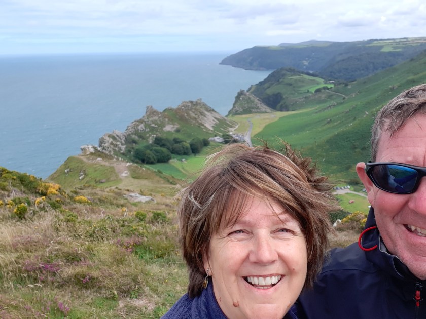
Our roadtrip through France this time is purely with the aim of getting to Italy.  However that doesn’t mean we can’t enjoy the journey 😊  Not for us a whistlestop tour of toll road plazas and the parting with copious sums of cash along the way.

No, we prefer to take our time (within reason) and experience all the beautiful countryside and charming little towns that France has to offer. 

In this post, we will take you on a journey through the southern regions of France, specifically focusing on a motorhome adventure that avoids toll roads. Along the way, we will share the free (or at least cheap) overnight stops that we used along the way, including Guarbecque, Muizon, Chaumont, Sennecy-le-Grand, and Bourgneuf on our way towards the Mont Cenis Pass into Italy.  Full disclosure – until we got to Bourgneuf and met @Happy2Dream (Gary) we thought we were going through the Frejus tunnel…

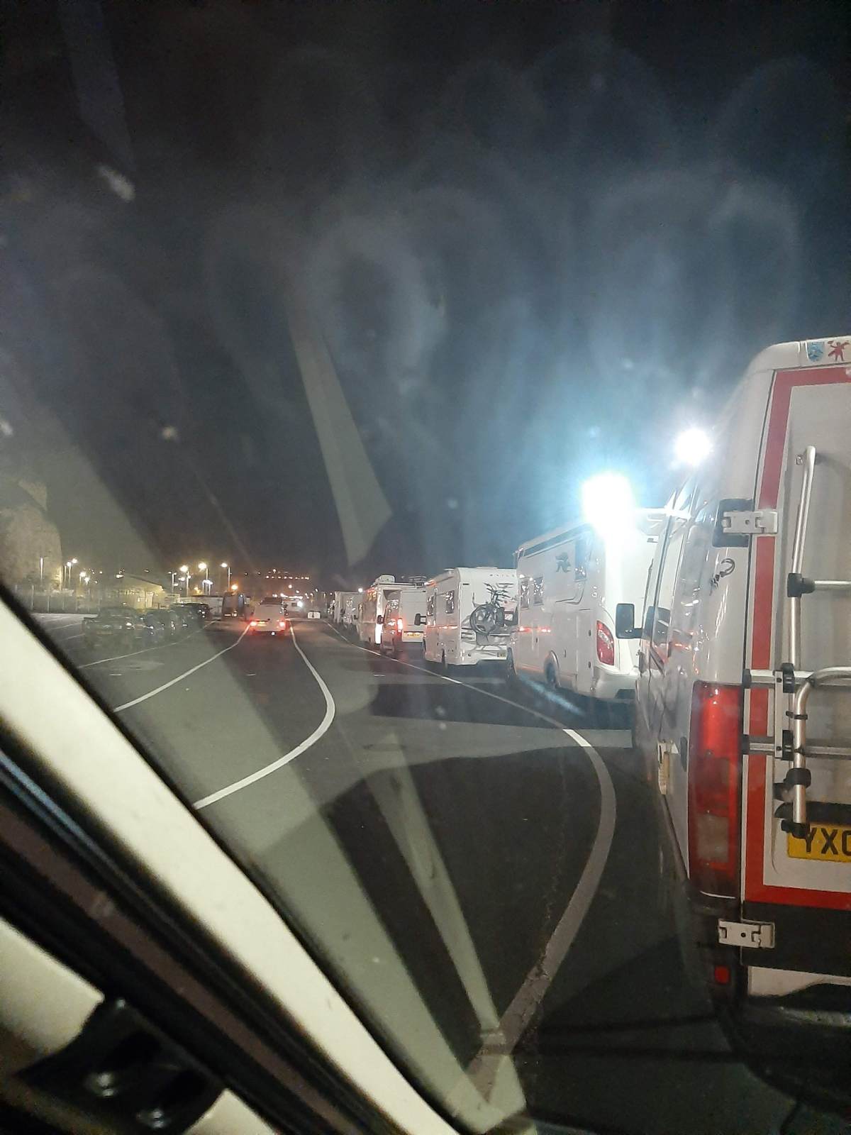
We came through the tunnel from Folkestone to Calais simply because I had Tesco Clubcard Vouchers to use and it only cost us £8.  It’s not the best route for us – we would usually come on the ferry from Newhaven to Dieppe (although Portsmouth to Caen is far more convenient!)

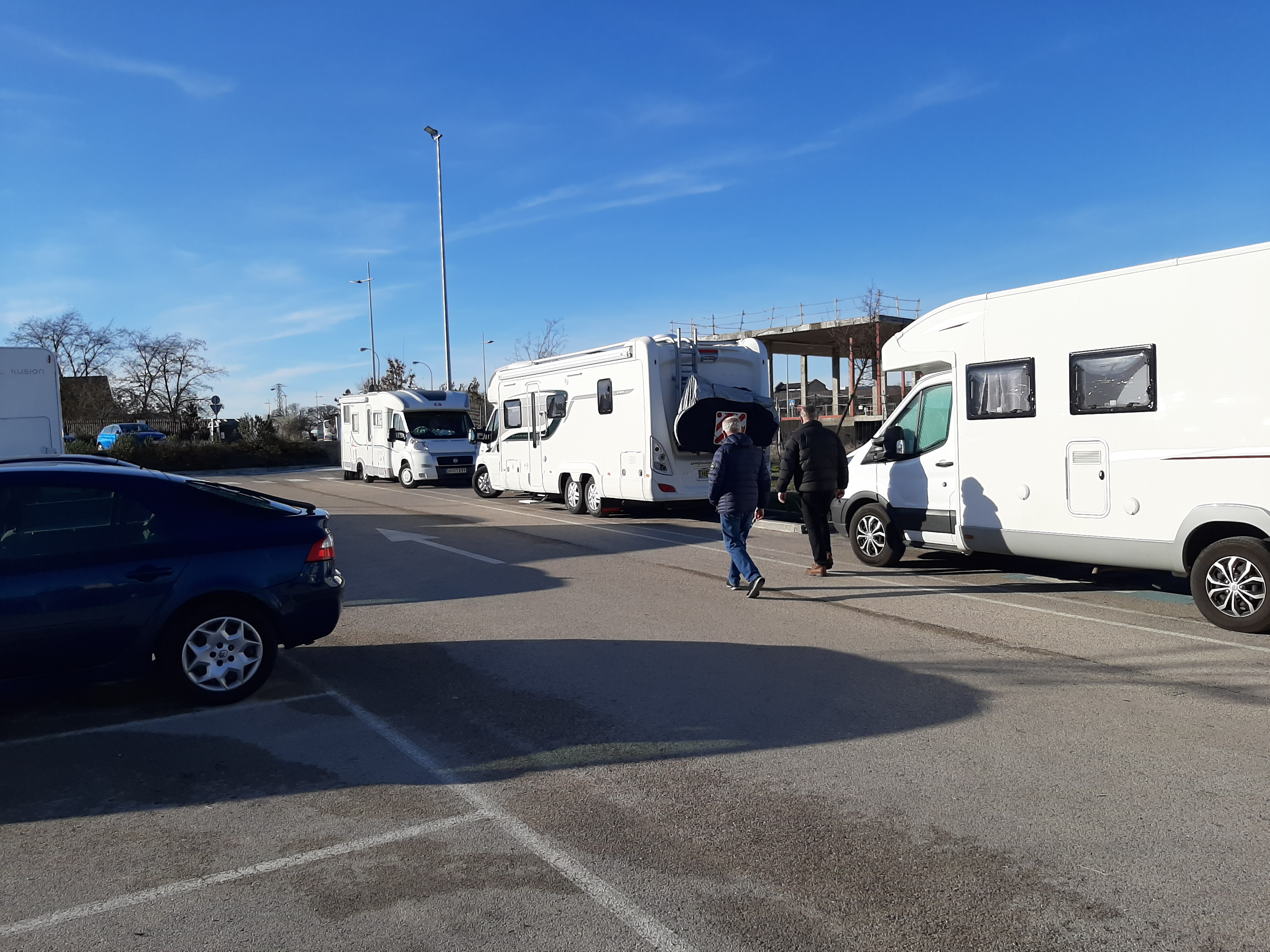
We didn’t want to drive too far on the French side, and it was just as well that we’d already researched where we were going to stop, as you’re straight onto the motorway when you disembark the train!

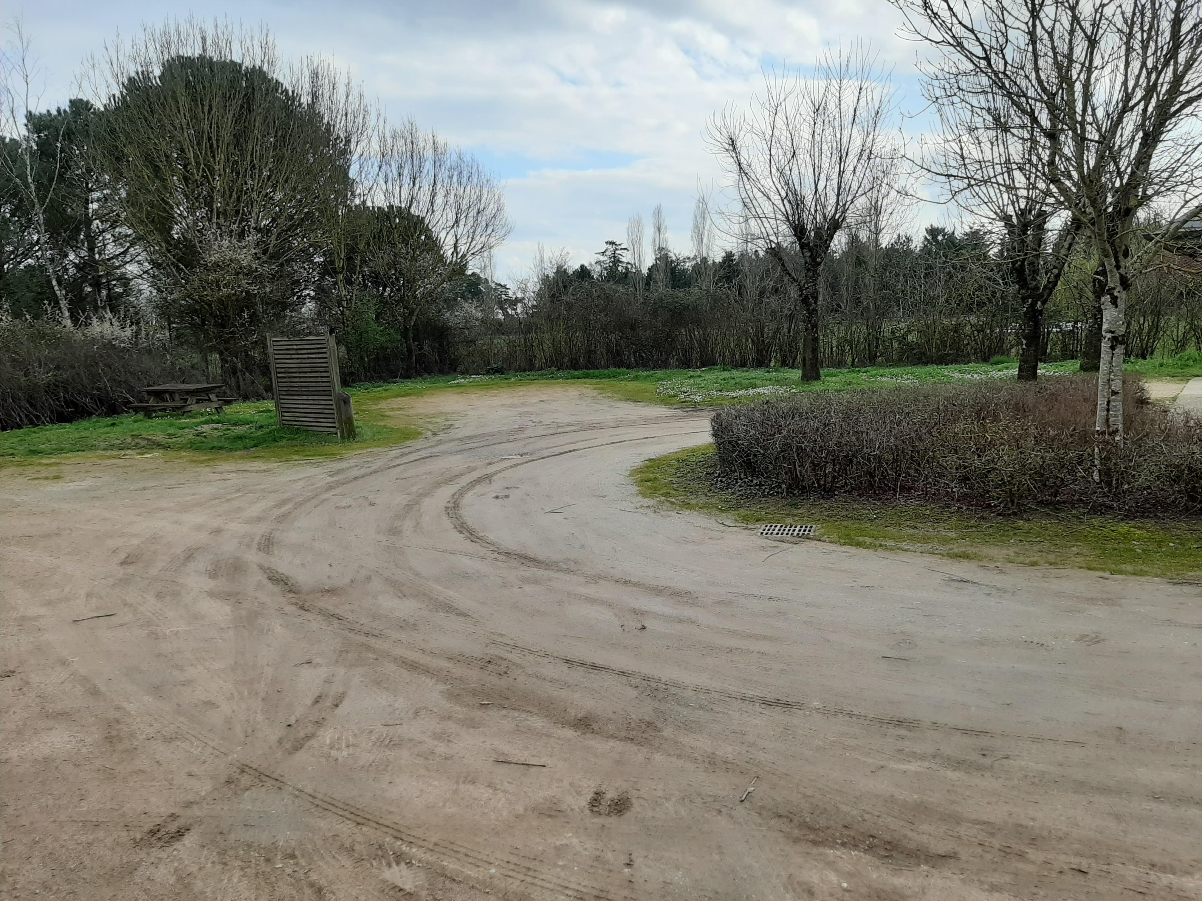
  1. 1st Stop – Guarbecque: A little village in Northern France as we embarke on your journey south, the small village of Guarbecque mad for an ideal first stop. The area alongside the canal offers a free overnight stop for motorhome travelers.

However, the area was taken over by a temporary bar and stage which nearly put paid to our plans, until a car parked by the little climbing park left and we were able to tuck ourselves out of the way for the night, watching the massive barges as they passed by creating giant swells

  1. 2nd stop – Muizon (2 nights here): This wasn’t quite so straightforward…  We headed to our 1st choice of stopover, only to find it completely taken over by gypsies.  They had even blocked the entrance with a van, and were busy routing pipes to any water source they could find.  We quickly re-routed to a city stop that Calv had found – cue panic (mine) over the 1 way system (until I got my head round it) and then an inability to get into the Aire.  Helped by a local we got in to find it full and not really suitable for our size of van.

So we had to stop for a few minutes, in which time we found a spot a few miles out of town which led us to head to Muizon, which, it turned out, was a charming little village and provided an excellent base for exploring Reims.

We were quite happy to leave the van at the Aire and hop on a train (station about ½ mile away, taking under 10 minutes & 14 Euros to get to Reims).

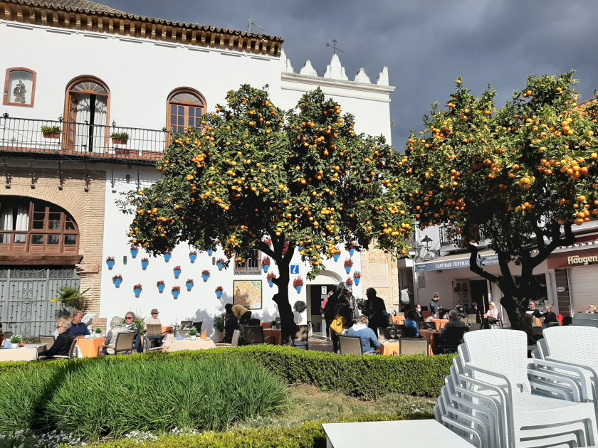
We’d never visited Reims before, but knew it was famous for its breathtaking Gothic cathedral and Champagne houses. We visited the cathedral, catching a mass confirmation in progress – we then visited a bar and I felt the need to partake of a glass of the bubbly stuff (which was very nice indeed thank you very much!)

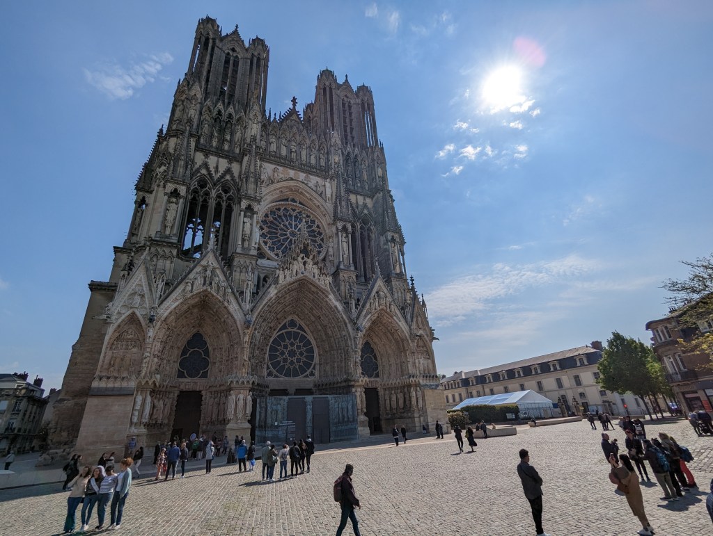
Then it started to rain….  Actually that’s a bit of an understatement – we had a massive thunderstorm!!  It was absolutely spectacular, but sort of brought the day to an end – and there wasn’t a train back to Muizon until 4.25pm (it was a Saturday)

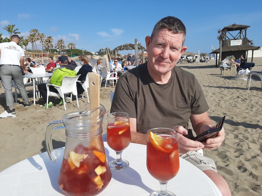
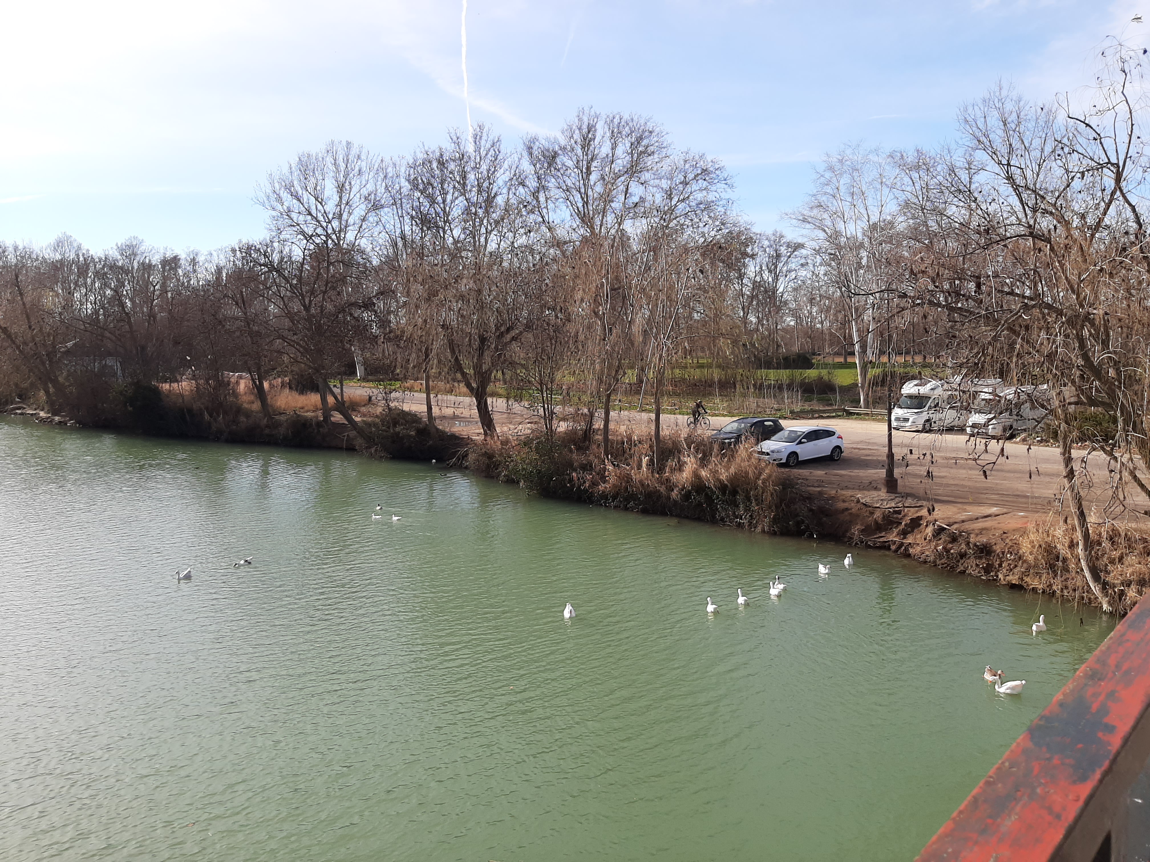
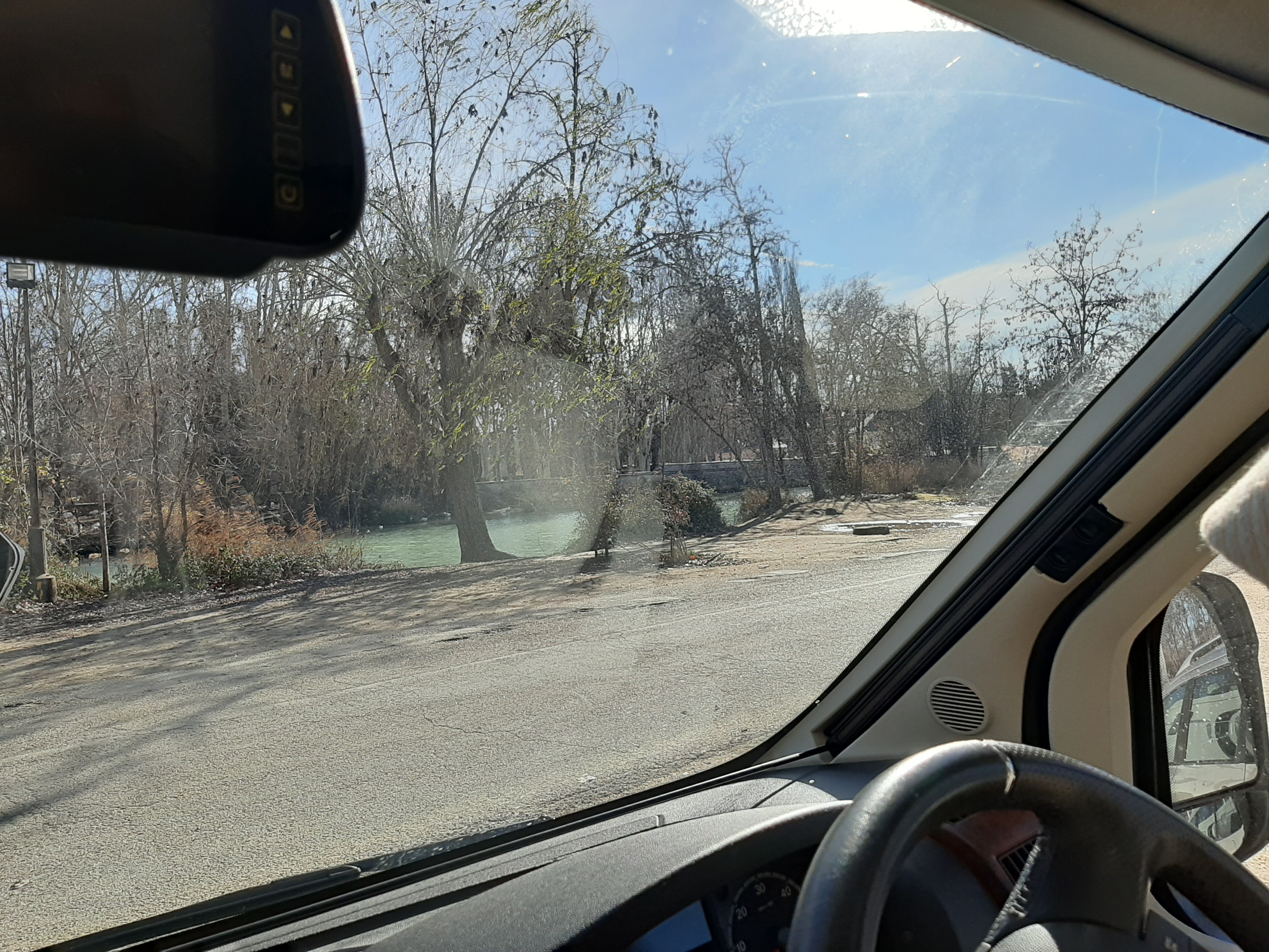
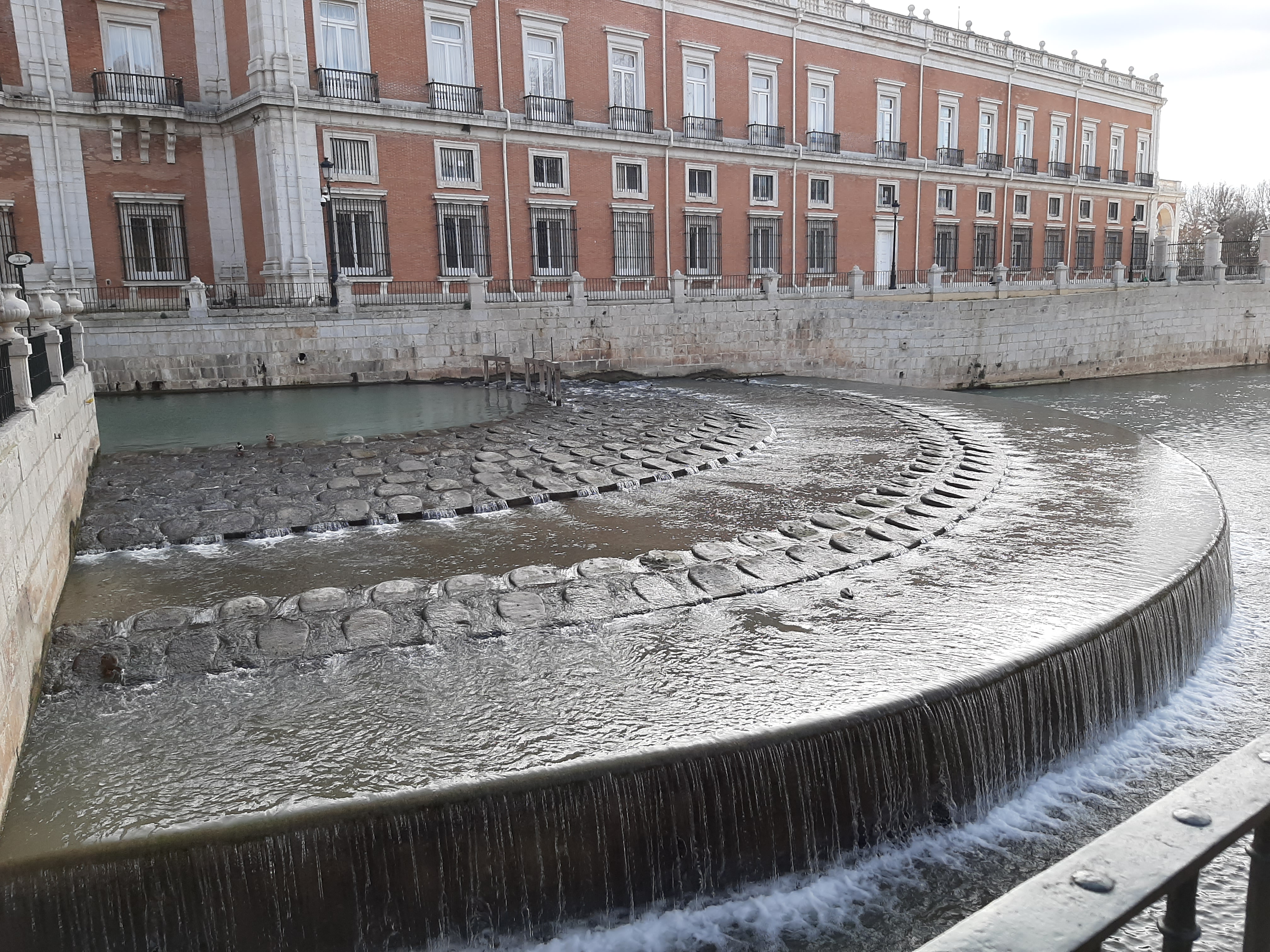
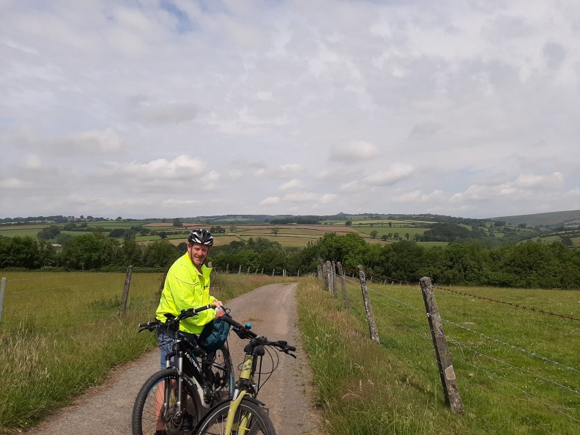
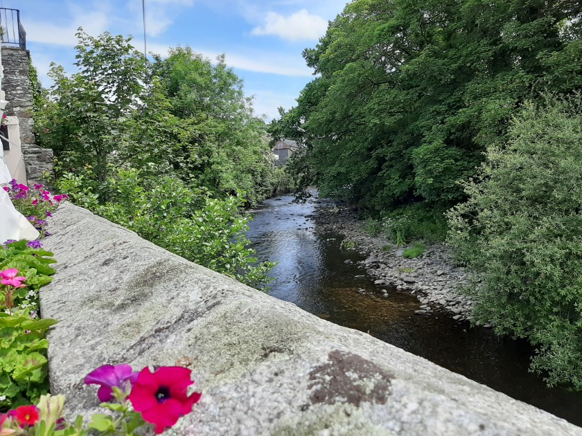
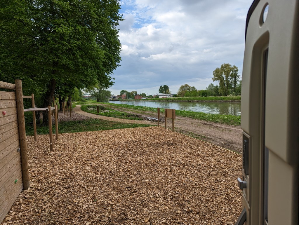
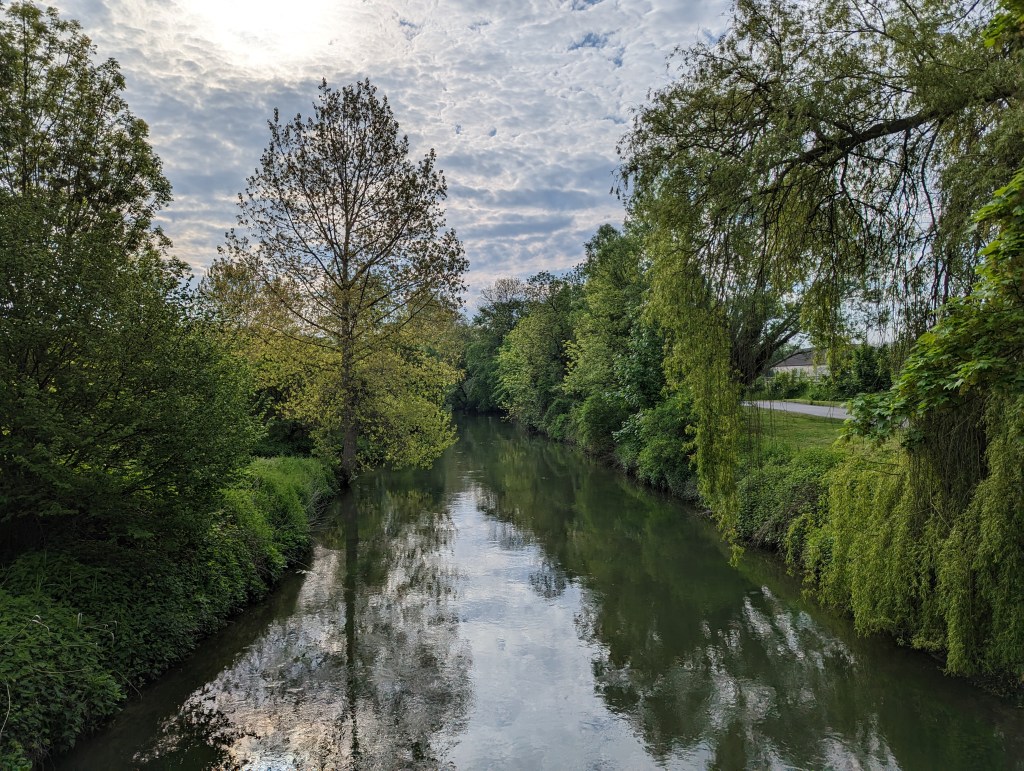
  1. 3rd stop –Chaumont: Continuing southward, we stopped at Chaumont, a charming town situated along the canal. Here, we found a peaceful spot by the water to park up for the night. We had to pay for this one (shock/horror!!)  A whole 8.44Euros… We took a leisurely walk along the canal (it’s also a cycle path and runs for miles), watching the locals fishing and listening to the frogs (we didn’t manage to see any though)

I ran the other way alongside the canal in the morning managing a respectable 2.8miles.  I know I should have completed a 5k, but I just didn’t have it in me ☹

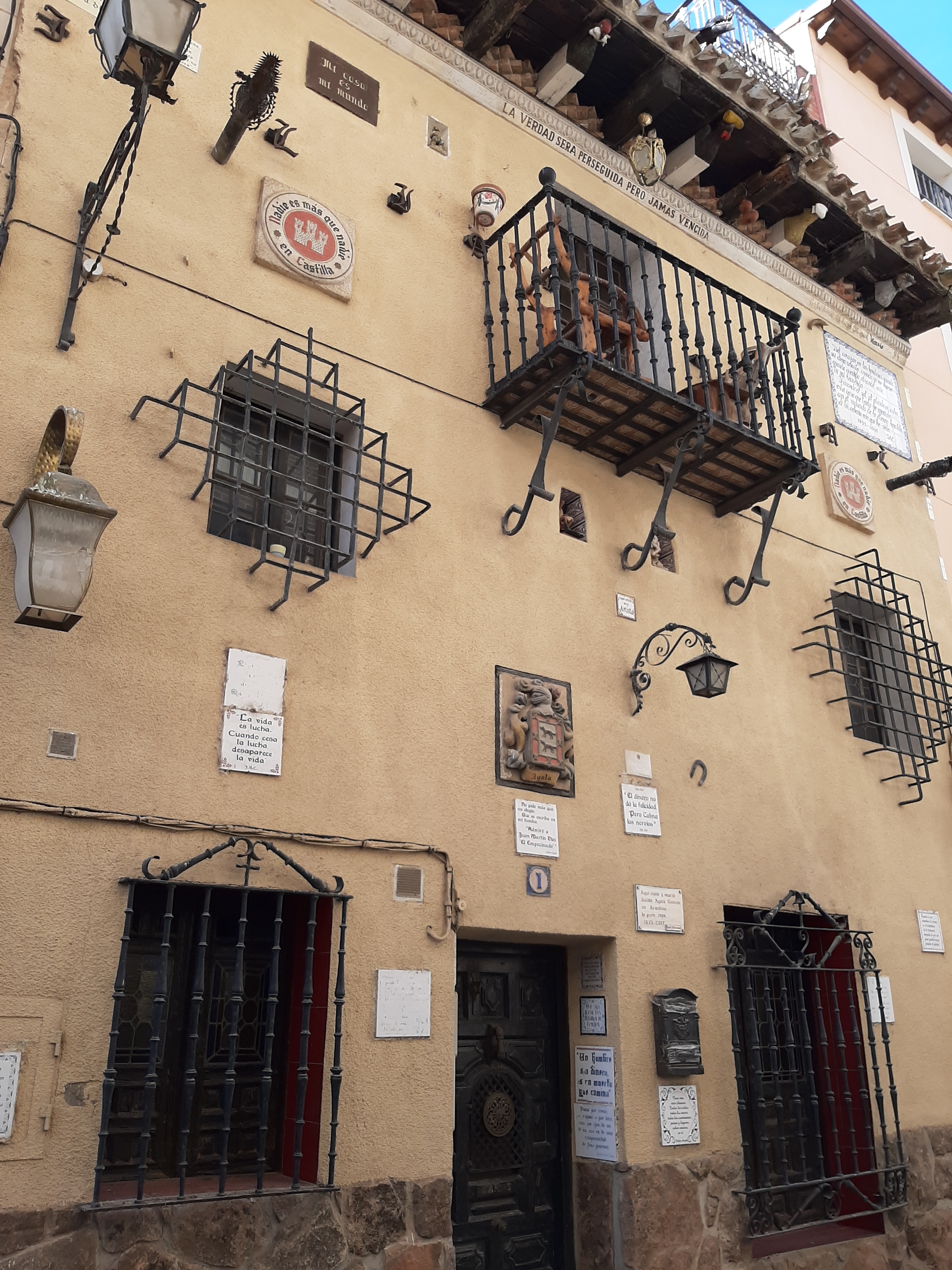
  1. 4th stop – Sennecy-le-Grand:  On leaving Chaumont we drove for about half hour before reaching Langres, which had been our 2nd choice for a stopover.  On seeing the walled town as we passed by we decided it was lunchtime, so we stopped and had a wander 😊 So glad we did – it was an absolute delight!

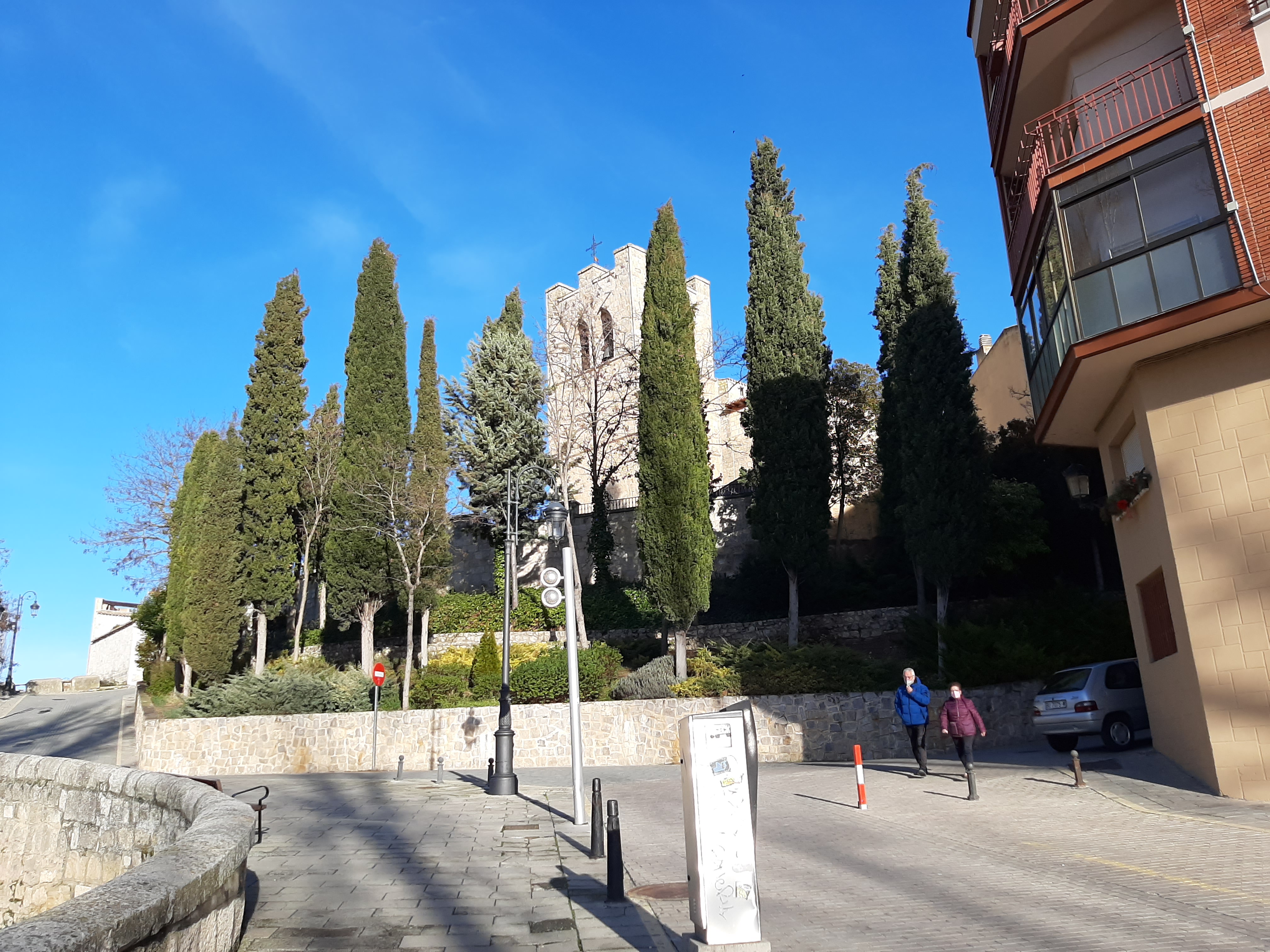
Once we arrived in Sennecy we felt like royalty parked up next to the Castle! We already knew this area, having stayed a couple of miles away at Chateau d’Eperviere a couple of times.

It was a lovely stopover but very near the road.  It would have been nice to visit the SAS museum, but sadly it wasn’t open.  We did go for a short walk in the evening taking in some of the lovely buildings (as well as the castle, the church and the trees with holes in their trunks).

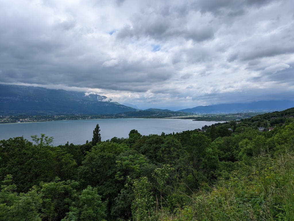
  • 5th stop – Bourgneuf:  We decided to take the ‘wiggly’ route (maybe we should rename the blog ‘The Wiggly Way’??) towards the Alps.  Calv definitely enjoyed this more than the more straightforward routes, and it was a lovely route, taking us through the Tunnel de Chat and passing by the Lac de Bourget on exit (we stopped for lunch here 😊)  Pedestrians and cyclists have their own 1500m long tunnel!

Bourneuf itself is a tiny village in Savoie on our way to the Frejus tunnel (or so we thought)  Here, we had a lovely stop-over in the shadow of the Alps.

This is where we met Gary of @Happy2Dream and we ended up going to the local bar with him, chatting with the locals (a couple of young lads keen to learn a little more English and help me with my French).  One of those evenings that will be forever remembered fondly.

When hearing that we were going through the tunnel Gary’s response was ‘Why??’.  His van wasn’t much smaller than ours and he advised that the Mont Cenis Pass was perfectly doable for us, and we decided to travel over it together (he later told us he wasn’t intending to go that way at all, and was absolutely shattered the next evening!!)  (The drive over the pass will have it’s own separate post)

In conclusion, driving south through France, while avoiding toll roads, allowed us to experience the country’s diverse landscapes, quaint villages, and rich cultural heritage at our own pace.

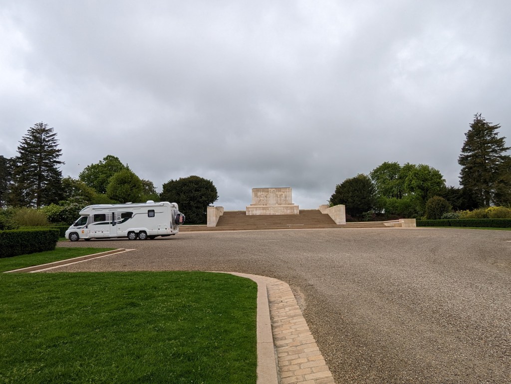
Along the way we visited War Cemeteries and learned about the 1st tanks to be used in the war.  

All in all, a long, but enjoyable, first week on our latest roadtrip which cost us 8.44 Euros and our fuel!

3 weeks between Malaga and Marbella in a motorhome

A short summary of 3 weeks on the south coast. It gets more interesting once we leave this area (but we have been before, so see previous posts for more detail)

Cabopino Beach

We already knew that we were heading for Cabopino when we got south, the only question was for how long. It started out as 7-10 days but ended up as 3 weeks – I’m not quite sure how this happened, but it did mean that we were able to have a night out with Steve and Denise’s friends for Steve’s birthday before we left. Apart from that 7-10 days would have been more than enough.

We really didn’t get out and about much as we don’t have the car with us and it’s not cycle friendly unfortunately.

So, where did we go?

Well we went, on the bus of course, to Marbella old town, La Cala market (Calv and I walked the 5 miles back) and Fuengirola. Other than that we just had walks and trips to the beach and, of course Happy Hour down at Jorge’s on a Friday 🙂

Buses are really cheap over here. It cost us just over 6 Euros per couple to get to Marbella and back, less than 3 euros to get to La Cala de Mijas and just over 3 euros to get to Fuengirola. Very good value 🙂

Marbella old town is definitely worth a visit with a number of lovely squares. La Cala de Mijas has numerous bars and eateries together with a lovely beach. Fuengirola is surprisingly nice as well with a long promenade along the beach.

We also got back to ‘running’ (both of us) and I did a fair bit of swimming.

I’m sorry it’s a bit boring, but it does get better once we left Cabopino and started seeing new sites. I will try to update much quicker now!!

Santander to the Costa del Sol in a motorhome – how to enjoy this journey :)

Parked up at Area de Autocarvannas in La Guardia de Jaen

Last time we took the ferry to Spain in January 2017 we went into Bilbao and had to then spend 5 nights at our 1st site in Zaurutz whilst waiting to get my tablet back (I’d left it in our cabin…) This wasn’t a major issue though as we were taking our time to reach the coast, via Pamplona.

This time however (January 2022) we docked in Santander (after a nightmare journey – read about it here), and the intention was to travel in the most direct manner south. Together with our travelling companions, Steve and Denise, we decided on the next night’s stop each evening. Actually, let’s be honest here, Steve and I found each evening’s park up between us!

We decided on 3 overnight stops before reaching the coast – it can, of course, be achieved quicker, but we wanted to enjoy the journey and see some new sites on our way.

So the 1st leg was Santander to Aranda de Duero just south of Burgos, roughly 150 miles in total. We stopped in an approved area with services, by the river and had a wander into the lovely little old town across the river. I also met a lady who had the misfortune to have had the same horrendous crossing as I experienced – only this poor lady hadn’t benefitted from the comfort of a cabin 😦

The following day we made it a further 125 miles south to the beautiful town of Aranjuez just south of Madrid. We had been somewhat concerned about negotiating our way around or through Madrid, but it was Sunday and we decided to head straight through (on the motorway of course!) You just need to keep your wits about you and make sure you follow the signs for Cordoba/Granada. I think I was more stressed than Calv trying to ensure I got the navigation right!

This time our stop off was by the side of a river, and just before a campsite (Camping Internationale). We parked up and headed straight across the bridge to the Palace Gardens to follow the river into town. Sadly the Royal Palace was closed, but plenty of bars were open, and we took full advantage. This is a lovely place and we would happily return for another visit.

We had a slightly longer journey the next day (about 175 miles) heading to an Area de Autocaravannas that I’d found in La Guardia de Jaen– it looked wonderful but some of the reviews suggested that we might struggle to reach it in our van. We decided to give it a go anyway as we were coming from the north. Absolutely no issues were experienced and this spot is an absolute gem 🙂 We stayed 2 nights in the end. The only problem was that it took us 3 attempts to find the little supermarket open, and the only bar open at all while we were there was a very local one – Calv poked his head through the door and said it looked like someone’s front room filled with men (exclusively) smoking and drinking.

We saw a red squirrel in the trees in the valley by the area, and Calv and I walked up to viewing point high above us – a very steep climb; one of those that was as bad coming down as going up! We also walked around the town and up to the castle (sadly closed), around the back of the castle to the church (similarly closed) where there were additions tacked on where families were living, down to the garage to get drinking water – there was another bar here that was actually open – entailing another steep climb back up to the van.

The guy in the van beside us also stayed a few days and he used to go off cycling for miles while his wife sat in the sun relaxing 🙂

Click on the link above for advice on how to arrive at this area (i.e. we would recommend that you don’t try and come through the town itself, you need to approach from the north, which might entail going past and then coming back on yourselves). This is probably the best free stopover we have ever stopped on (although Algodanales in the hills north of Ronda comes a very close second 🙂 )

After La Guardia de Jaen we headed for the coast and 1 last free night (in Cala de Mijas) before arriving at Camping Cabopino for a few weeks. We had to go via Granada having found a Caravan Dealership where we could buy ACSI cards (we had ordered ours before christmas but they hadn’t arrived before we left home).

This final stint we did in 1 hit (apart from the stop to buy ACSI). We know the free area in La Cala (de Mijas) well from previous stays, but on arrival we were shocked at how many motorhomes were there! It’s normally very well policed, but they were spilling over outside the accepted area – there must have been 3 times as many vans as would normally be allowed 😦 We decided to stay for 1 night however (it’s very handy for a night out)). We were now able to head out to do a proper shop – we tried the Aldi (not too keen tbh), and then headed back out to Lidl in the morning for the bits we couldn’t get in Aldi!

A meal in El Gusto (because Biddy Mulligan’s shut the kitchen at 5pm – their loss, we discovered El Gusto next door and will return!) was most welcome and very, very good.

We did see last week that the car park has now been cleared of the excess motorhomes and there is just the corner now available (as per usual – there’s still about 30-40 vans in there though)

We’re now settled at Cabopino for a few weeks and in my next post I’ll tell you about trips to Marbella Old Town and La Cala de Mijas (on the bus!)

Portsmouth to Santander on the ferry

We have now spent our first night happily in Spain. I have now recovered from the nightmare crossing!!

This is the 3rd time we’ve crossed this way – twice to Spain and once home. We never intended to do it again after the last time, but of course we’re not allowed to traverse through France at the moment….

Our first crossing to Bilbao back in January 2017 was wonderful. We were confused as to what everyone was going on about when they said how awful it was. I didn’t have to retreat to the cabin once, except to sleep of course.

Our second crossing was 10 weeks later out of Santander. This time I managed a few hours out on deck before having to admit defeat as we navigated the bay of biscay. I then couldn’t get up for the rest of the crossing! Although I was able to eat a little and drink.

This time. This time…!! Wow. Well it was relentless almost from the start. Boarding just before 10.15pm I did actually see the public areas as we had a quick drink before going to bed just before midnight – I was already needing to lay down. And that was it tbh. I barely moved for the next 32 hours. Not because I was being lazy you understand, I simply couldn’t get upright, not even to sit! During those hours I managed to eat a quaker breakfast bar (it took me all day), drink half a can of coke, a cup of green tea and half a bottle of water. Heading to the loo was a bit of an issue as I had to be upright, obviously (sadly those bodily functions don’t shut down in times of stress)

Yesterday when we parked up for the night at Arando de Duero, I met a lady who suffered the same as me but was far worse off, only having a seat, not a cabin.

Calv said the boat was very quiet in the public areas and that the food was ‘okay’. I think this crossing was particularly awful due to the weather – when I snatched the odd 30 seconds looking out of our window – all I could see was high seas with peaks and troughs constantly roiling. The boat was beaten on all sides all the way – it was truly horrible. 🤢

There was a highlight. I managed 30 seconds of watching a large school of dolphins jumping in and out of those waves (before I had to lay down again) – that was a real privilege 😊

Anyway the conclusion is that I never want to do that crossing again, ever. So we’re really hoping that France will let UK nationals drive through by the end of March. Please, keep your fingers crossed for me! Thank you 😁

Tavistock – Ancient Stannary Town and Birthplace of Sir Francis Drake. Absolutely charming!

What’s a stannary town? Read on to find out! Tavistock is absolutely charming and has the added benefit of being on the route of the N27 cycling route

We have moved on from Cornwall; not far though, just as far as Tavistock on the western edge of Dartmoor.

There’s an awful lot to say about Tavistock. First of all, it’s absolutely charming with many of the Abbey ruins dotted around the town. The 10th century Benedictine Abbey must have been huge as the ruins are so well spaced out – some in the grounds of the church, and then the Still Tower (where medicines were made) still standing alongside the river, as well as the gates. The museum is housed in one of these gates, but was unfortunately closed during our visit.

The Still Tower by the Riverside

The town was granted it’s market charter in 1105 and a market has been held there continuously since then. Nowadays this is mostly held in the purpose build (1860) Pannier Market with many regular stalls. We were drawn in by 2 of these stalls and bought a few gifts (a couple of which were for us!) Around the outside of the market building there are many cafes serving local produce (including, of course, pasties and cream teas).

Tavistock Pannier Market

Speaking of cream teas, Tavistock is apparently the home of the Devon cream tea (cream with jam on top – of course!) The story goes that a group of workers making repairs after a Viking attack in 997AD were rewarded with bread, clotted cream and strawberry preserves – the rest, as they say, is history 🙂

Devon Cream Tea (at Badgers Rest, Dartmeet)

Tavistock’s most famous son is Sir Francis Drake, and there are many nods to this around the town – from street names, shop names and statues to the cycle path winding through the town.

Statue of Sir Francis Drake

The N27 cycle path goes through Tavistock on it’s way from Ilfracombe to Plymouth. The section from Tavistock to Plymouth is known as ‘Drake’s Trail’. We used it to cycle from our campsite in Peter Tavy (Harford Bridge) and were really impressed (this was 1 of 2, mainly off road, cycle routes into town – and the easiest of the 2 we used). There is ample cycle parking near the town hall (opposite the Abbey Church).

On arriving in town Calv continued cycling along the N27 with me desperately trying to rein him in – ‘You’re on your way to Plymouth’ finally worked! The park alongside the river (which contains tennis courts, a BMX track and, of course, a bowling green) is rather lovely and brings you back, if you walk along by the river, to the wharf and the start of the canal, some of which is underground.

We ate lunch in the EastGate Bistro, again alongside the river, enjoying local produce, including beer and wine 🙂 Very nice too!

We returned the next day to make our purchases in the Pannier Market (we wouldn’t have been able to carry them home on our bikes). We parked up on the top road near the road up to the hospital (and the town steps) where it was free. On the way back we took the long route – completely unintentionally, especially considering we didn’t just have our purchases to carry, but those of fellow campers who were on their bikes! This resulting in a steep climb up the town steps and a steep descent down them back to the car – Calv wasn’t impressed with me…

By the way, I promised an explanation of what Stannary Town meant. Stannary means this was where mined metal (tin and later copper) was weighed, stamped and assessed for duty. Click here for more detailed information.

All in all I would definitely recommend a visit, or 2, to Tavistock. We will very likely return 🙂

A New Discovery in North Cornwall – Porthcothan Bay :)

Cornwall – the most beautiful place in the world – especially North Cornwall 🙂
A new campsite found (to which we will return), and meeting with old friends.
This was a very special part of our trip 🙂

It’s been a few years since our last trip to Cornwall, but, considering it’s my favourite place in the world, it won’t be our last!

This trip in particular was a bit special. Not only was it wonderful to be out and about in the van again, but we were meeting up with friends who we hadn’t seen for nearly a year. AND we got to watch England beat Germany in the Euros together. What more could you want??

We discovered a site (Old MacDonalds Farm) that not only gave a wonderful first impression, but managed to build on that as our stay progressed – if we hadn’t had other bookings (due to worrying about being able to get in anywhere if we didn’t!) we would have stayed longer without a doubt.

We had 5 nights here and crammed a far bit in – here’s a summary:-

Looking out at the Petting Zoo (and the Alpacas) from the bar

Day 1 – Arrived (via a typical Cornish lane – meeting a tractor coming the other way!) We drove down (we were tired) to the Bay (it is walkable, but probably about 3/4 mile and quite a trek back up the hill!) There is a bus though 🙂

The beach is beautiful. The tide was out and we just walked out to the surf’s edge, exploring all the little caves and coves along the way.

We also noticed that all the beaches in this area have ‘litter picking’ stations, which is a wonderful idea. If we had been staying longer Calv would most definitely have got involved 🙂

Day 2 – It rained all night and didn’t stop all day, so we pulled on our wet gear and walking boots and headed out to get some fuel for the little car at St Merryn. Calv said the shop was amazing! So any camping needs should be filled here 🙂 We then took the road opposite the garage (and past the chippie) down towards Harlyn Bay and Trevone Head.

Initially we kept going straight on taking us past the golf course and driving range, before turning round and taking a left down towards the 2 holiday parks. There are 2 national trust car parks down here to take in the views or visit the bays. At the end of the road is the Trevone lighthouse – but the road goes no further!

We came back to the 1st car park and walked, in the rain, down to the delightfully named Booby’s Bay, which links up to Constantine Bay. I scrambled down to the beach via some rocks only to walk around the corner and find some wooden steps! Beautiful golden sands and patrolled by lifeguards, this was a lovely find.

Then we got a call from our friends to say they were waiting for us at our van! So we headed back and had a lovely afternoon catching up before they carried on to their holiday home in Padstow (normally rented out – #seaviewpadstow).

Day 3 – We headed slightly south to Bedruthen Steps, from where we walked to Mawgan Porth and back, a total of 5 miles. We didn’t know we were going to walk quite so far, and on leaving Mawgan Porth we decided to try to avoid the diversion on the cliff path (they’re putting in steps) by walking up the hill on the road (next to the Pitch and Putt). We thought this had worked, but the path ended up taking us back down to the beach anyway!! Massive fail…

An evening at #seaviewpadstow (our friend’s holiday cottage in Padstow) finished off the day. A taxi back to the campsite cost just £15 (although the taxi driver was pretty miserable!!)

Day 4 – Steve and Denise bought our little car back and then we took them back to Padstow, via Padstow Farm Shop (very disappointing) and Tesco’s. They later joined us at the campsite to watch THE match of the Euros so far (England v Germany in case you’re wondering) in the bar. The evening rounded off with a buffet meal outside the van and a few games of boules.

Day 5 – Our last day on site. We had a lovely sunny day so lathered on the suncream and took the kayak down to the bay. Great fun, especially surfing the waves back into the beach and even though Calv then tipped me out into the shallows – bless him….

Our last hurrah was to go back to Padstow for a wander before collecting Marie and Steve to come to pick up their car from the night before. They had all been on a Boat Safari during the day – seeing lots of dolphins 🙂

This part of the country is simply amazing – beautiful beaches, country lanes and stunning landscapes. A new view around every corner (and a tractor of course!)

We Stayed:Old MacDonalds Farm, Pothcothan

Next Stop: – Peter Tavy, nr Tavistock (Harford Bridge Camping)

Walk Lynmouth to Watersmeet (just like Julia Bradbury did)

Perhaps a little more challenging than you would have thought from the ‘Best of British Walks’ on the telly… But what a wonderful walk. You do need a fair degree of fitness to tackle the 2nd part, but you could turn back after visiting the tearooms to avoid the steep bit!

A couple of days following our extended walk down into Lynmouth we felt ready to tackle the walk that we had seen Julia Bradbury complete on ‘Great British Walks’ – they showed the easiest bits of course!

We drove down to Lynmouth, parking in the car park by the river. This is where the walk starts and we lost no time having breakfast or anything this time! We headed straight to the back of the car park to cross the river by the small footbridge. The river is so pretty here it’s difficult to imagine that this is the new course forged as a result of the flood in the 1950’s.

The walk starts nice and gently, meandering along the riverside, through the trees with a choice after about 1/2 mile of continuing along the river or heading directly through the woods. We chose the riverside as we knew there were a few areas of interest to see.

This part of the walk is easy and very pretty. We found the site of the Lynrock mineral water factory right alongside the river. They also made ginger beer here right up until 1939. The Atlee brothers who owned the factory lived at Myrtleberry which you pass a little further upriver. Read all about it here.

After a couple of miles you reach Watersmeet House which is now a rather lovely tearoom. Unfortunately we visited shortly after businesses had been allowed to re-open and the Cream Tea available was not freshly made, which was rather disappointing. We shall just have to return in happier times 🙂 (Sounds like a perfect excuse to me!)

After our little break and a quick chat with a fellow camper from our campsite we headed off for the more difficult part of the walk (at this point we didn’t know just how hard it was!) But first we took the detour further upriver (and it was UP) to find the waterfalls. Which we initially walked straight past, only realising our mistake when we got to the road… (Incidentally, if you were to be staying at the same campsite we did – Lynmouth Holiday Retreat – you can see a sign on the road for The Beggars Roost (which is at the entrance to the site), so we think you could probably walk back from here if you wanted to).

Heading back downhill we spotted a small set of steps down to the river which led to a viewpoint to see the waterfall. Remember it had been a very hot, dry summer thus far, and as such the waterfall wasn’t flowing very strongly…. We think it is probably far better in the spring or autumn.

We got back on the correct path (behind the house), which starts climbing almost immediately. And keeps on climbing forever (well, it felt like it anyway – I did consider turning around and going back the easy way at 1 point….). Then, just when you think you’re at the top you turn a corner and, oh look, it’s still going up. Didn’t tell us about THAT did you Julia??!! No, I think you mentioned that there were a ‘couple’ of steep sections after the house. Hmmm…

Having said that once we finally reached the top the views were stunning, and then we had the pleasure of finding a rather nice pub, The Blue Ball Inn at Countisbury, for a well earned 2nd pitstop 🙂

Suitably refreshed we set off for the final section of the walk along the South West Coast Path. Accessed via the churchyard we visited the tiny church of Countisbury, which was rather charming, before picking up the path along the cliff.

Whilst we were glad to finally be heading downhill, it was quite steep in places of this narrow path on the edge of the cliff… Once again though, stunning views 🙂 culminating in a welcome return to Lynmouth to give a final total of 7 miles hiked.

And of course a quick drink in The Ancient Mariner topped the day off nicely!

We would highly recommend this walk even if it’s just to the tearooms and back to Lynmouth. We will almost definitely return and do it again!

Next time read all about our adventures (and walks…) in Symonds Yat!

Related Posts:

Walking in Lynmouth and Lynton

Travelling to Lynmouth? Don’t do what we did!

A weekend in Symonds Yat

Walking in Exmoor – Lynmouth, Lynton, West Lyn

A ride on the Lynmouth/Lynton cliff railway has been on my bucket list since way before I knew what a bucket list was! Recent appearances on travel programmes re-ignited my interest, plus a walk on Julia Bradbury’s Great British Walks ignited Calv’s interest too – so was the 1st stop on our UK mini road trip decided 🙂

After a slightly stressful run-in to Lynmouth (don’t take the A39 – read why here), we settled down for a few days of walking.

We arrived the day after a big storm and the weather was still a bit dull, but the following day was much better, and we set off, pretty early for us, at about 9.30am.  The main reason for this is we were looking for somewhere to treat Calv to a big English Breakfast on his birthday 🙂

We found the footpath out of the site and set off down the lanes and across the fields to head down the hill.  Some wonderful views greeted us even at this early part of the walk.

wp-1596036378908.jpg

Once we hit the path we weren’t sure which way to go, so we headed left as this seemed the most logical direction. We were wrong as this took us back up the hill and around a gorge back downhill, before heading back up to meet the road skirting Lynton – meaning a walk along the road (some of it on the road) steeply downhill into Lynmouth. It wasn’t a problem, at least we saw more of the countryside!!

Arriving in Lynmouth we headed down towards the main area where there is a good selection of tourist shops, bars, cafes and pubs 🙂 We were here at the end of July so everything was open with social distancing protocols and masks in use.

At the far end of parade of shops we found The Ancient Mariner, just the right degree of quirkiness and a simply wonderful breakfast. We liked it so much we returned a couple more times during our trip 🙂

Revived by our breakfast we set off in search of the cliff railway that I had spent so many years wanting to visit. We first found the seafront and the Rhenish Tower (originally built in 1860 to store salt water for indoor baths, it had to be rebuilt after being destroyed in the disastrous flood of 1952). The historic cliff railway cannot be missed (both literally and figuratively), carving it’s way at a seemingly impossible gradient up the hill as it does! And it is still completely water powered.

At £3 each way for an adult (£2 per child, £1 per dog) it was well worth the total cost of £12 (we came back down later on in the day). A childhood dream finally realised!! I can’t wait to go back and do it again. And again. And again 🙂

At the top we took a walk around Lynton which is a bigger town than Lynmouth with more choice of shops and eateries. Perhaps not quite as charming though.

Completely by chance we looked at a info board in front of the town hall (and cinema. Apparently Lynton is the smallest town in England to have it’s own cinema) and decided to follow the walk up Hollerday Hill to find the old Hollerday House. There really was no evidence left of the house when you got there, the most complete area left was where the tennis court had been, although there is a really good information board.

Once you have walked up (and I mean up) as far as the house it is definitely worth walking the extra 5/10 minutes to the summit of the hill and the site of the old Iron Age Fort. It was VERY windy on the summit, but what a wonderful view we had – to the east the bay in front of Lynmouth, to the west ‘Valley of the Rocks’ and to the North the Welsh coast. We really wanted to visit The Valley of the Rocks, but simply ran out of time. Yet another reason to return 🙂

Once back down in Lynmouth we popped in for a drink in the Ancient Mariner before visiting the Glen Lyn Gorge . This perhaps feels a little expensive at £6 per adult, but it is privately owned and they have provided plenty of pathways up to the waterfalls, together with the loan of a mobility scooter that can get the less abled up to see these. The little museum is brilliant. Once the families left we had the place to ourselves (in these Covid times we waited for them to leave) and we were in there a fair while!

You learn a fair bit about the flood of 1952, which devastated the town, here. The other place is the Flood Memorial Hall which is near The Ancient Mariner. It’s free to visit but was unfortunately closed when we were in town (due to Covid no doubt).

So now we had to get back to the campsite. We knew we had to go uphill, but asked the guy in the Gorge what was the best way. The answer is to go to the right on leaving the gorge, and very soon there is a pathway up through the houses (we missed it at first, but I really don’t know how!!) You start off following the Two Moors Way (Devon’s coast to coast walk).

It is very steep, right from the start. And it doesn’t really get any better for a good long way…. Once off of the tarmacked path and into the trees you zig zag for what seems like miles (and not helped by people coming the other way telling you you’ve still got a long way to go!) before hitting the flattish path near the top. Here to get back to the campsite (Lynmouth and Lynton Holiday Retreat), you need to turn right. Then you will find the gate into the field waymarked for West Lyn. Good luck 🙂

This was a really long day and I’m sure you can imagine our legs were really tired, having walked over 11 miles – half of it up really steep hills. So we didn’t do much more that evening (not even a quick drink in The Beggars Roost...)

With tired legs the next day was spent visiting Ilfracombe. It’s so memorable that I forgot I’d been before….

In my next post I’ll tell you about our walk to Watersmeet and back to Lynmouth (the same walk that Julia Bradbury did on the telly).

We stayed: Lynmouth Holiday Retreat

Related Posts: Travelling to Lynmouth? Don’t do what we did!

Lynmouth to Watersmeet walk

Our Next Stop: Greenacres Campsite, for Symonds Yat

Walking and Kayaking at Symonds Yat

Travelling to Lynmouth and Lynton? Don’t do what we did…..

Vital advice on how to get to Lynmouth/Lynton in a motorhome or with a caravan. Put it this way – you need to drive much further than you would think (when just looking at a map). You need to take the A361/A399 rather than the obvious looking A39…. Trust me, and read on!

First thing to tell you is that that picture isn’t us!!  It’s a library photo trying to show you the problems on Porlock Hill.

On Monday, after a very hectic week or so, we set off on our mini UK roadtrip – first stop Lynton and Lynmouth.

We took a cursory look at the map, saw an A road (the A39) and decided that was probably the best route; set up the sat nav (an Aguri set up for our outfit, which we then proceeded to ignore as we thought she was being stupid – we are humbled and will never ignore here again!!)

We simply had no idea about the A39 (also known as the Atlantic Highway) you see.  So this is how we ended up, accidently, tackling Porlock Hill.  If you haven’t heard about Porlock Hill can I respectfully suggest that you have a little read about it here….

When we got to the hill (remember, we had no idea about it), the first we knew about any issues was the notice at the junction of the hill itself and the alternative route of the toll road.

Bottom of Porlock Hill

Note, the sign says that caravans are ‘advised’ to take the toll road.  Let me spell this out, in case you’re in any doubt, DO NOT TAKE YOUR CARAVAN OR YOUR MOTORHOME UP THIS HILL!!  I was going to say ‘especially if it’s been raining, or there’s dew or any sign of damp’ – however, this suggests that it’s okay for you to tackle the hill – which it’s not…. So I won’t say that!

The hill is 1in4 (or 25%) – think about that. That means that the road climbs 1 foot for every 4 feet travelled forward.  It also has tight bends and steep drop-offs (luckily I didn’t really see these).

As the road got steeper the front wheels starting losing traction briefly.  At this point I shut up, held tight, gritted my teeth and hoped for the best.  When we got to a sharp left hander about halfway up on the steepest part of the hill, we lost traction again, but this time we coudn’t regain it.

So, we’re stuck in the middle of the road, with the nose poking forward instead of around the bend – we’re going nowhere 😦

But, we had a little advantage in that it was Calv in charge.  We jumped out, unhooked the car, I jumped in and promptly reversed into the bank (not helpful really), Calv rolled down the hill and around me before he could regain traction on the other side of the road.  (If you watch videos of people tackling this corner you can see that they all take it on the other side of the road).

By the time I rounded the bend he was gone, once started he floored it and made it to the top where we pulled into the first available parking area to re-attach the car.

Then came the downhill section into Lynmouth where we stopped and unhooked the car again, as we realised we were going to have to go up again to get to our campsite.  This road up past Lynton to West Lyn was almost as steep – put it this way, in the little car I barely managed to get out of 1st gear – I tried a couple of times, only to have to quickly change back down.

Never have I been so relieved to arrive at a campsite – we certainly won’t be making that mistake again!

However, we’re going to pretend that we did it on purpose (and that we’re not actually idiots) so that we could tell other people about it 1st hand 🙂  (Are you buying that??!)

We’ve now researched the route for if you’re visiting this area, and would recommend the A361 to the A399.

Let me know if you’ve ever made the same mistake (it would be lovely to know that we’re not the only ones!)

Happy travelling everyone!

Related Posts:-

Our Campsite in Lynmouth – Lynmouth Holiday Retreat

Walks & Days out in North Devon


European Tour cut short by Coronavirus Crisis

Did you start a European holiday only for it to be cut short? Here I talk about our recent experience of exactly this. Here’s hoping everything will be able to go back to normal soon and we can all start visiting each other again xx

When I wrote my last post we were newly in France with the 1st set of closures put in place (i.e. non-essential shops and business closed), but with the local elections set to go ahead the following day.  We felt fairly confident that our plan of making it to a site in the South of France and sitting out any further measures, should they occur, was still achievable…

Obviously this isn’t what happened!  However, it was a couple of days before this became clear – and it was rather sudden!

So I thought I’d give you a whistle-stop summary of our whole trip in just the 1 post!  So here goes…

Days 1 & 2:  Friday 13th & Saturday 14th March 2020 (perhaps there was a clue here?)

We arrived in Dieppe aboard a pretty empty ferry after a slightly bumpy crossing, and shared the Aire with a number of other vans (mostly French), before taking a walk around Dieppe (already socially distancing ourselves) and then spending a 2nd night in the same Aire.  (I wrote a post covering this already – click on the link above)

Day 3: Sunday 15th March 2020

We made the decision to use proper sites rather than free aires ‘just in case’, thinking that we would be able to stop on a site once we were there, and also to go further than we had originally planned.  So I looked through the trusty ACSI book and found a site in Sully sur Loire, about 100 miles south of Paris, Camping le Jardin de Sully  (You’ll be able to see my review here when I’ve written it!)

For us this was a long journey being 200 miles as we normally aim for under 100 miles.  Little did we know at this point that we would be driving almost 900 miles in total in the next 5 days before we made it home…

The campsite was lovely, and pretty empty, although there was another English couple in their caravan who were heading home via the tunnel because they had medical appointments and wanted to ensure they got home for them.

The French were out and about in droves taking walks along the river, and even in the evening the youngsters were congregating in their cars in car parks as they couldn’t go to cafes and bars.  We know this as we went out for a walk in the evening once, or so we thought, everyone else had gone home!  We were able to avoid these groups and walked for a few miles, crossing the bridge and finding the chateau (and the town Aire) and several closed bars and restaurants.  It looks like a lovely little town and we have no doubt that we will one day return to explore the area by cycle (the cycle path system is very good)

This slideshow requires JavaScript.

Day 4: Monday 16th March 2020

We had been thinking of staying here for a 2nd night, but in the end decided to crack on further South.  On checking out I told the lady what we were hoping to do – in hindsight it would have been nice if she’d mentioned that President Macron was due to address the nation that evening with an important announcement.  But she didn’t, and we had contacted 2 campsites that both said they were fully open… So we headed off further South.

225 miles further south to be precise to Vielle Brioude, south of Clermont Ferrand and Issoire.  We chose to take the toll motorway this time, as we were going so far.  Then I forgot to press the button when paying to explain that we were a camping car (the rate will be changed if you do this).   In my defence I was intent on seeing if my Halifax Clarity card would work this time (as it didn’t the previous day when we used a short section of toll, and I’d had to use my debit card); and I just completely forgot…  It probably cost us about 15Euros, maybe 20…   I won’t forget again!

Just before our destination we stopped at an Intermarch to get some essentials, and top up with fuel.  The supermarket was very busy with several items unobtainable, but we managed to get everything that we needed, and set off again to find the campsite.

A couple of wrong turns and slightly unsuitable roads later we found it, Camping de la Bageasse, which looked much nicer in the photos than in reality!!

We were the only unit there (although there were a couple of chalets in use), and once we’d chosen our spot and found electricity that worked (by now our fridge had stopped working on gas), we settled down for the evening.

This slideshow requires JavaScript.

In the evening the lady from reception came to see us to explain that the campsite was possibly to close in the morning after the president’s address.  Instead of waiting we spent the evening trying to book a ferry home.  We had problems with booking the DFDS ferry from Dieppe, and thought that we’d managed it, only for the site to crash on us again.  So we booked a ferry into Portsmouth on Brittany (at an extra £100).  In the morning though I had an e-mail from DFDS confirming our booking!

Thankfully Brittany Ferries were brilliant and cancelled our booking with an immediate full refund.  The receptionist also confirmed that the site was indeed closing and anybody on it being asked to leave.

Day 5: Tuesday 17th March 2020 (midday lockdown)

Approximately 425 miles to go, but 2 days to do this (our ferry was Thursday at 05.30am – changed from 6.30pm Wednesday foc by DFDS Ferries).

We chose to avoid the toll motorway this time as we had a bit of time.  But it did seem to take forever; so we ended up doing the last 30 miles or so on the toll; I remember to press the button this time and saved 9 Euros.  We were stopped once, just after midday, at a routine checkpoint on a roundabout – a show of our ferry booking and my ‘nous allons au bateau pour aller chez nous’ did the trick, and we were soon on our way with a smile and a ‘bonne route’.

We were then held up driving through a small town where we had to pull into a car park.  There were 2 other British vans in there with us.  A French lady also pulled up and started talking to me – I did pretty well, in that we sort of understood each other and she told me what had happened (sadly a little boy had run out into the road and been knocked over), but she just kept moving closer and closer to me!  In the end I had to run into the van saying my tea was getting cold!  (nb: I don’t understand why the police in France need to carry massive guns when attending a traffic incident in a small rural town though..)

I’d found a likely overnight stop in Mery sur Cher, west of Vierzon, and we were so happy when we made it there.  Absolutely perfect spot behind the village car park, but with a toilet, electricity, security lights and little individual pitches as well as the normal amenities.  The barrier had been removed meaning it was all free as well (although we would happily have paid).  I hadn’t been so happy in days!

20200317_154959

Day 6: Wednesday 18th March

The traffic increased as we made our way further north, although eerily quiet as we drove through Orleans.  Driving past Chartres I was, again, amazed at the size of the cathedral – you can see it from miles away and I must see it in reality 1 day!

From Rouen the traffic really picked up, and once in Dieppe we managed to get a little lost as we had never approached from this direction before 😦  This time we were 1 of only 3 vans in the Aire – we think most people turned up late and waited in line at the port.

This slideshow requires JavaScript.

Day 7: Thursday 19th March 2020

An early start (4.15am) to catch the 5.30am ferry.  We were pretty much at the back of the queue (see main photo – which doesn’t really show just how many motorhomes there were).

An uneventful journey home.  2 members of staff were operating the coffee machine for everybody as you got on (free), but there was no food being served.

All in all we were pretty happy to get home, although obviously absolutely gutted that all we had achieved in our week away was 2 fairly long walks and over 900 miles driving…

If things improve in the next couple of months however we will head off again, even if it’s only for a few weeks.

Stay safe everyone – and remember, this too shall pass and normal life will resume.  Maybe at that point we’ll all be a little more grateful for our normal freedoms 🙂